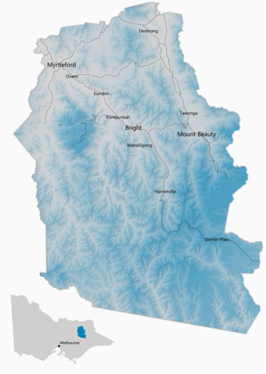
Alpine Shire Council provides a broad range of services to residents, ratepayers, businesses, and visitors.
Welcome to the Alpine Shire located in picturesque North East Victoria.
Approximately 12,000 people call our Shire home, surrounded by stunning natural beauty.
Residents and tourists enjoy its delightful climate, wide range of food and wine outlets, and great in and outdoor entertainment.
The Alpine Shire is about 300 kilometres north-east of Melbourne and 70 kilometres south of Albury/Wodonga. Its main towns are Bright, Myrtleford and Mount Beauty.
The Shire covers 4,790 square kilometres. Approximately 92% of that land is public land, including parts of the Alpine National Park and all of Mount Buffalo National Park.
Alpine Shire Council provides more than 70 services to its residents and visitors, and protecting its unique natural and cultural heritage. Council’s core values are: accountability, leadership, productivity, integrity, nurturing and engagement.

Tourism Information
You can visit the following sites for local tourism and events information:
